The Trail Times
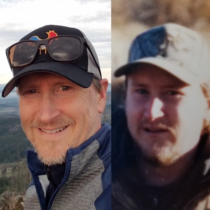
Running and hiking Oregon's trails with Peter Mathios
The McKenzie River Trail

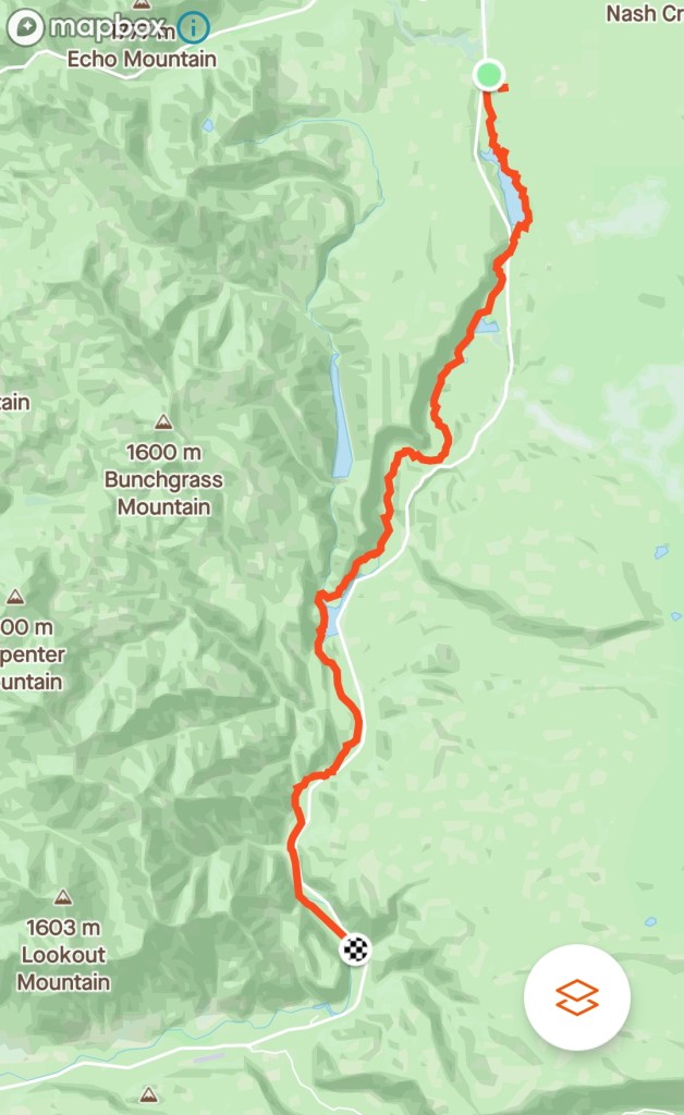
Well… most of the McKenzie River Trail anyway. The plan was to run the entirety of the trail, which according to All Trails, is 24.1 miles point to point. However, things didn’t quite go according to plan.

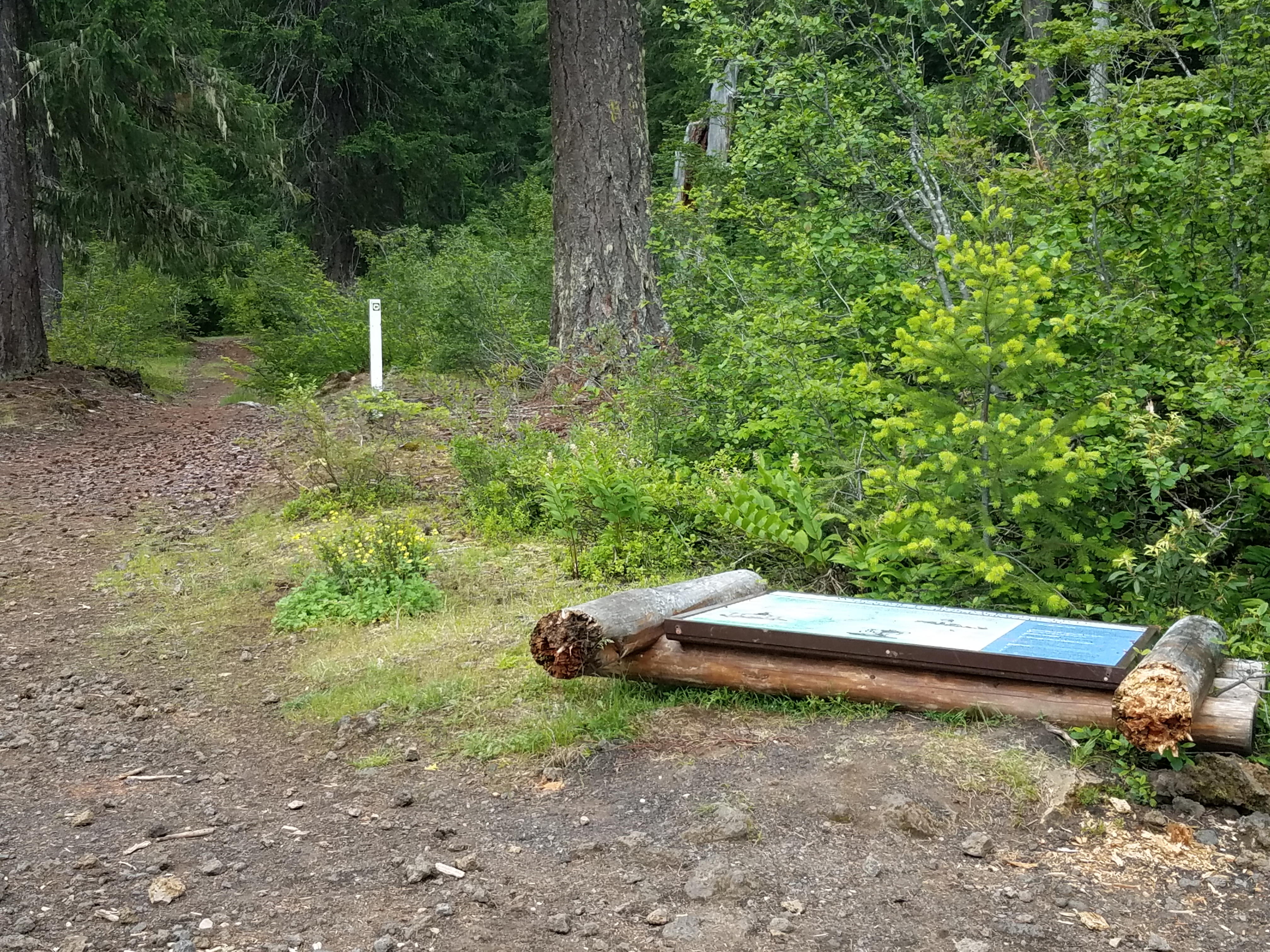
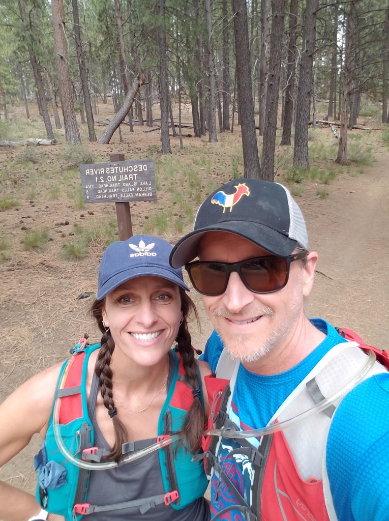
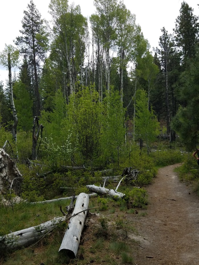
The McKenzie River Trail is well known among mountain bikers as a great ride. It’s generally downhill with a lot of sweeping, fast single track, but with enough technical rocky sections to keep even seasoned riders honest. My crew dropped me off at the trail head and in my excitement I ran straight out of the parking lot, right past the fallen signage, and blissfully onto the Old Santiam Wagon Trail thinking I was on my way.
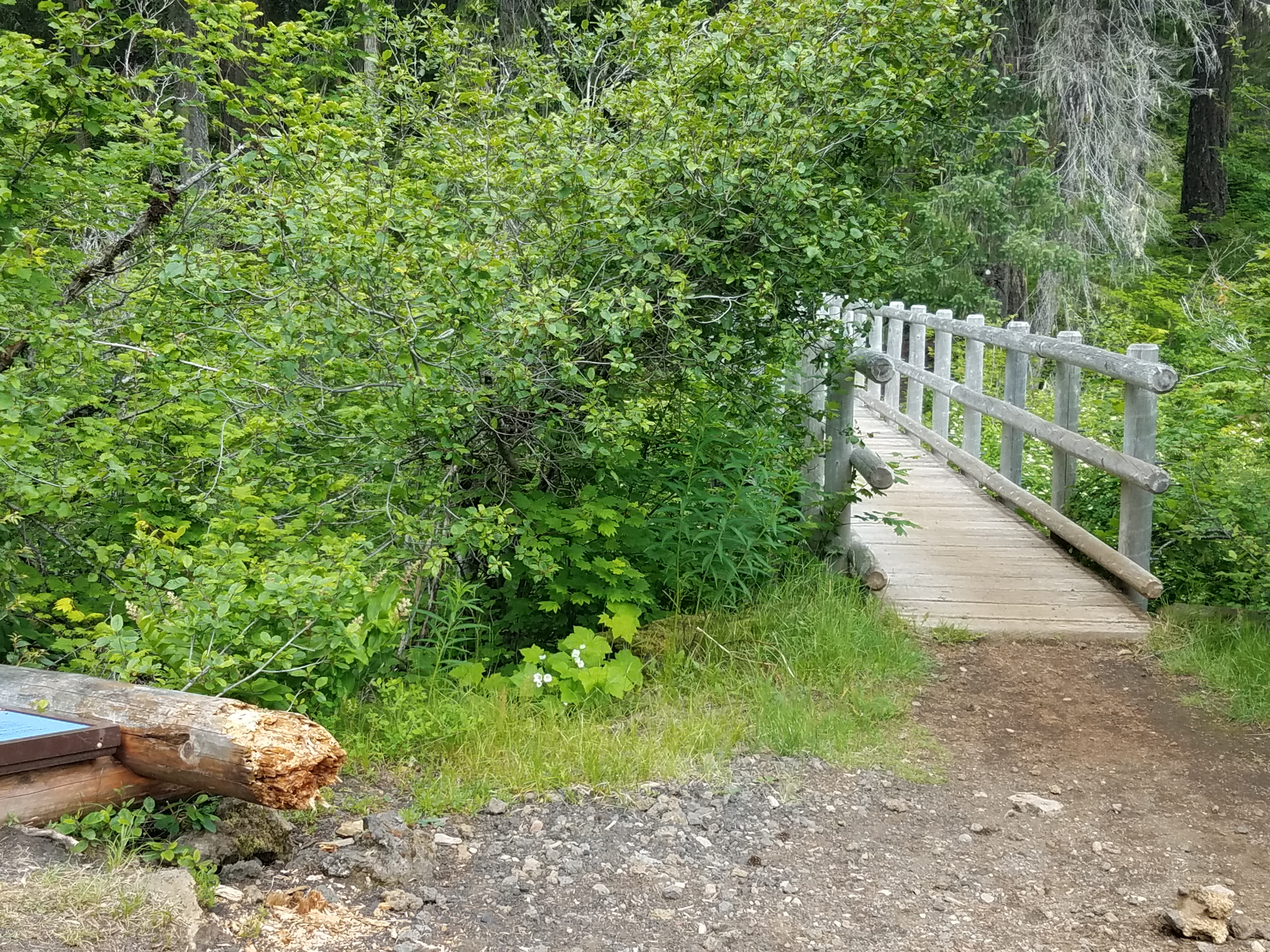
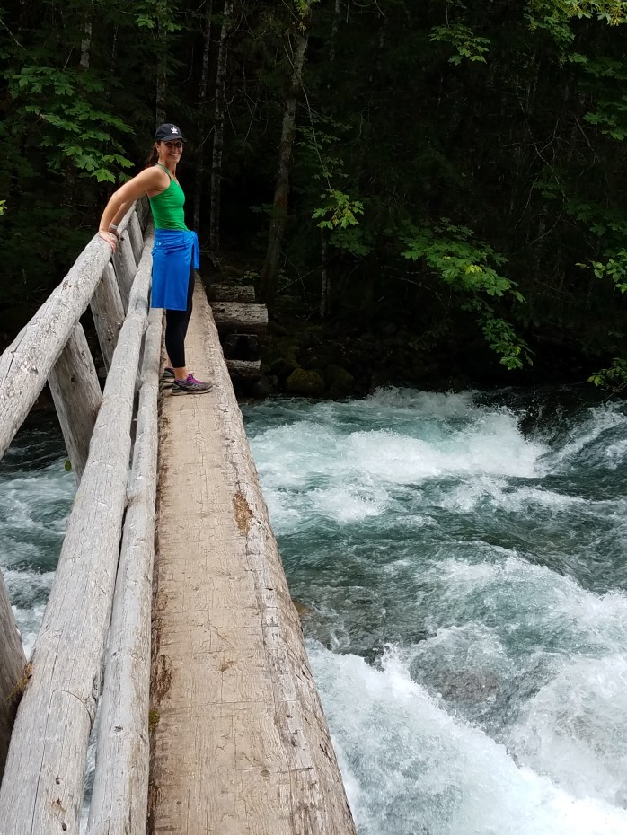
About a half mile in, something wasn’t feeling quite right. I checked my All Trails app and sure enough, I was heading southeast instead of straight south and was off course. A passing solo mountain biker confirmed the news and told me that I needed to cross the bridge out of the parking lot. So, after the first mile of running, I hadn’t even set foot on the McKenzie River Trail yet. Still 24.1 to go.
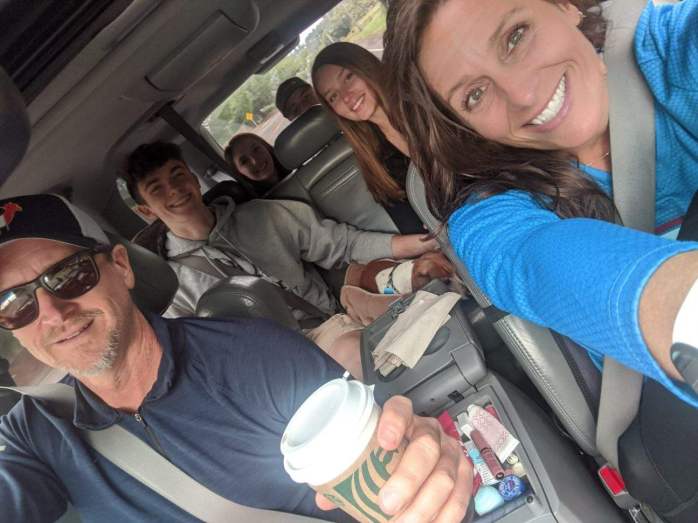
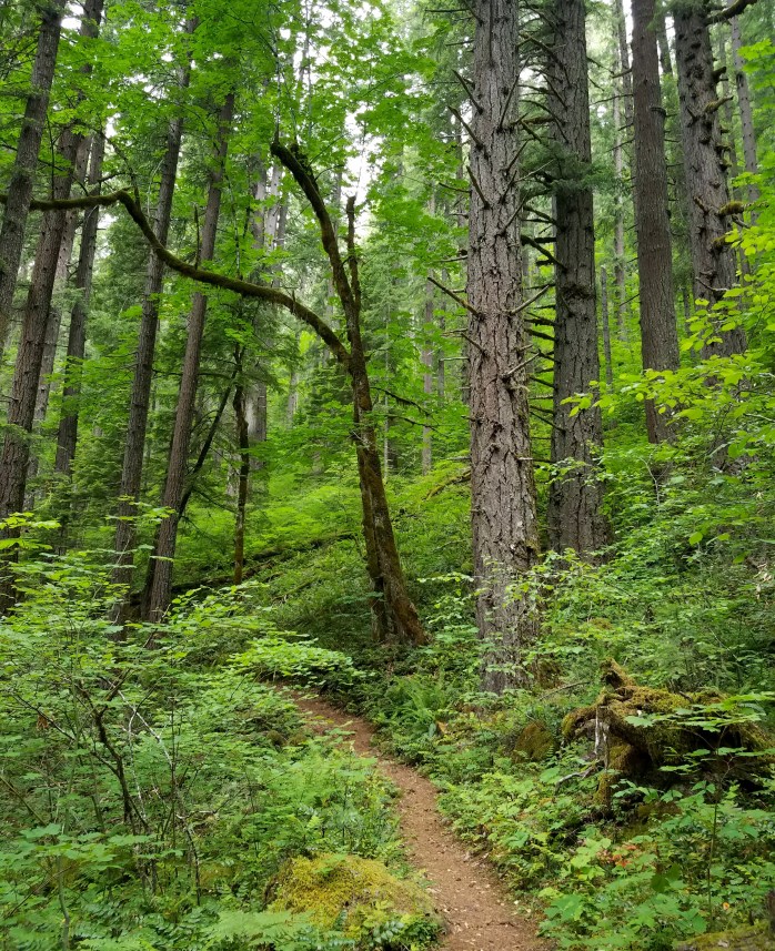
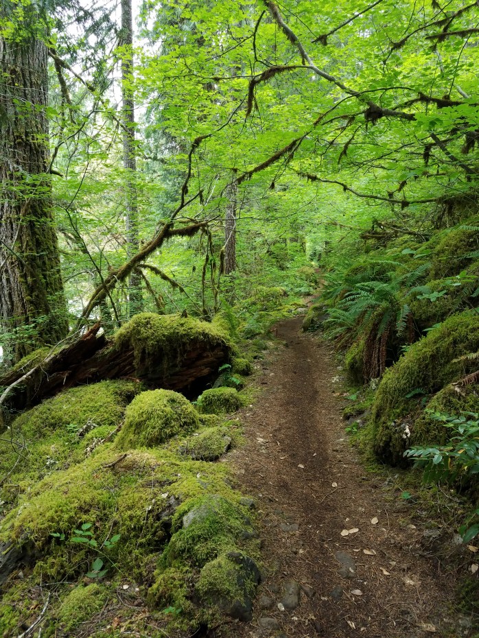
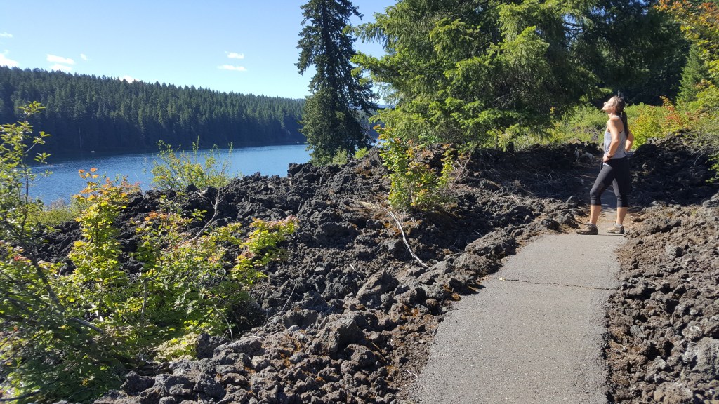
Back at the parking lot I wondered how I missed the sign. It was broken and on the ground, but still, it was pretty big! I crossed the bridge and was on my way. The upper part of the trail was beautiful, slightly downhill single track. And before I knew it, I was on familiar ground working my way through the lava field on the east side of Clear Lake (see earlier post). Being a Saturday, the resort was packed and there were a lot of boats on the water. My son and his girlfriend rented a rowboat and planned to fish since I was not planning to be at the first ‘aid station’ for a couple of hours. My daughter and her boyfriend were the official shuttlers on the trip as my wife was going to join me to run from the Blue Pool parking lot 10 miles ahead.
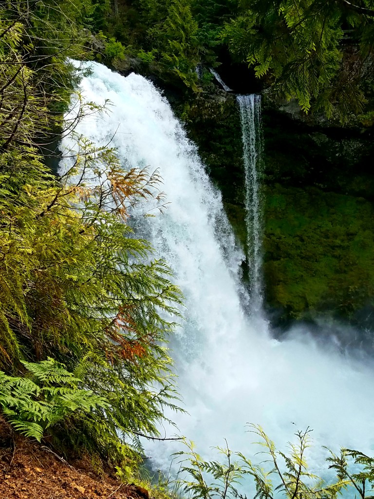
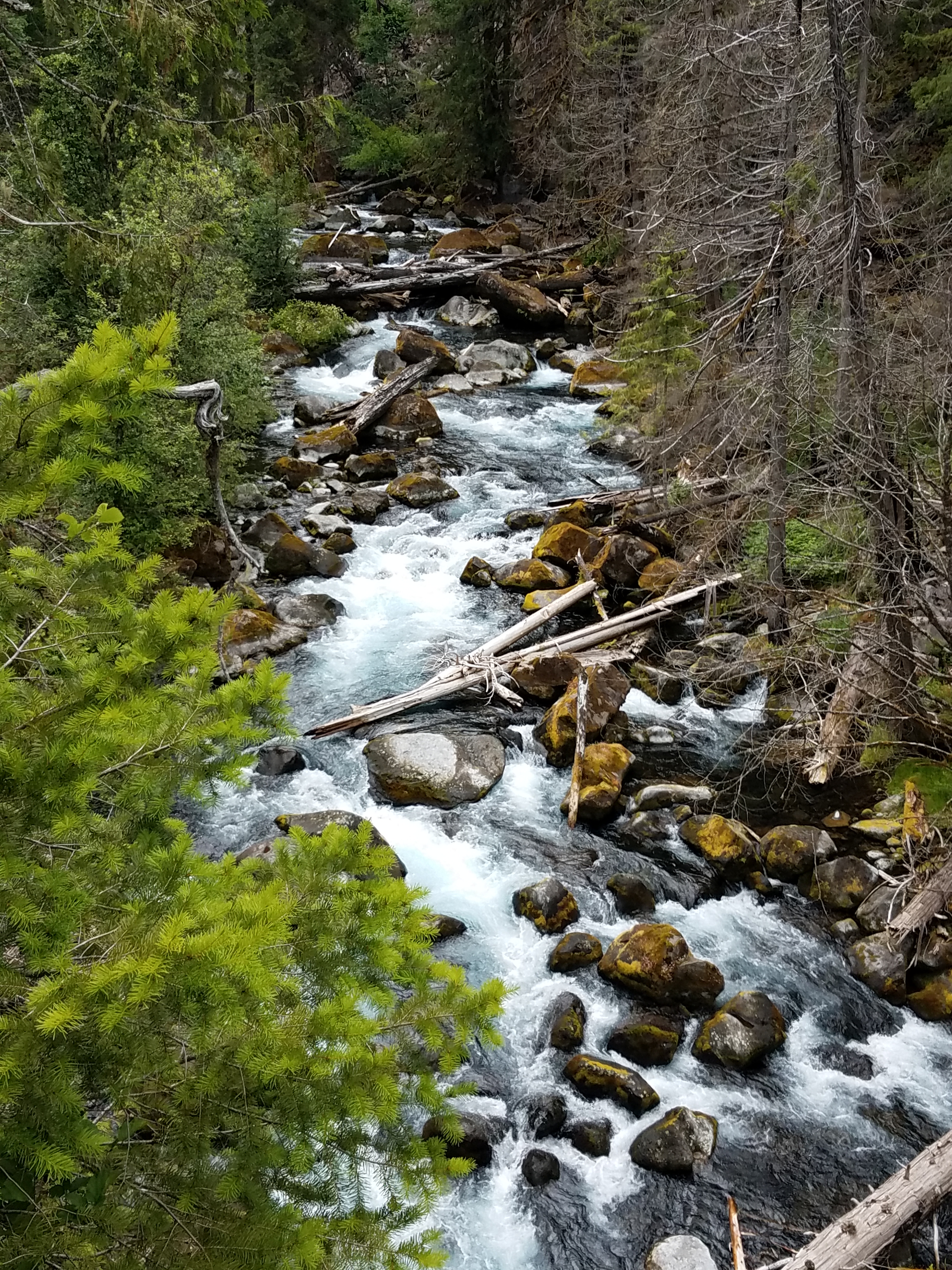
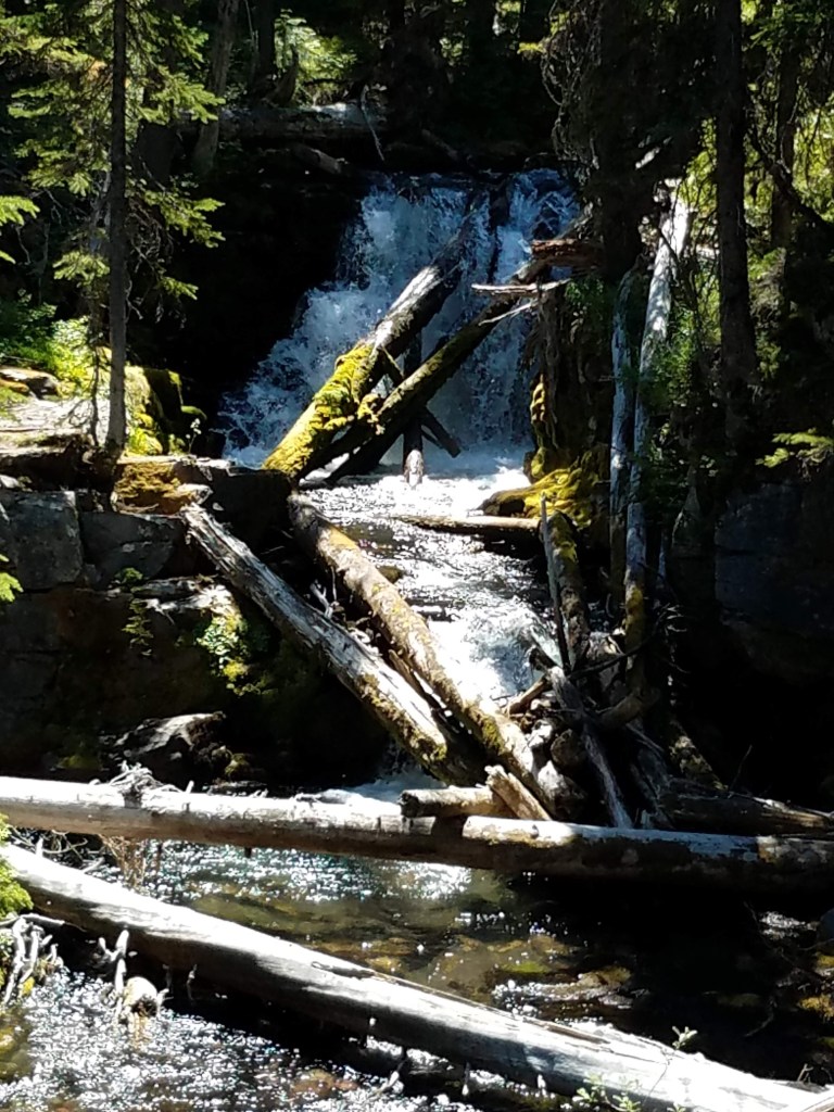
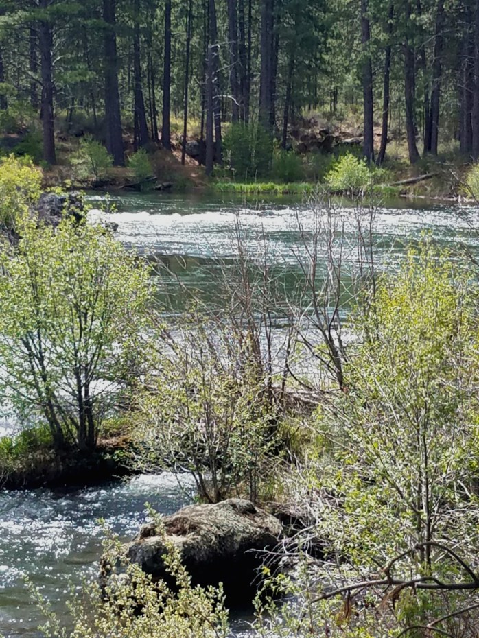
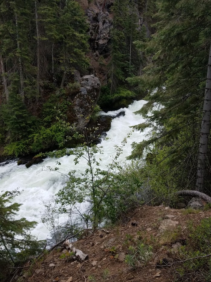
After crossing the river just past Clear Lake, the next major landmark is Sahalie Falls, the first major waterfall followed soon after by Koosah Falls. Through this section the trail is fairly technical, but very fun with fresh legs. Carmen Reservoir is just below the two falls. Here, the trail begins to smooth out and the river vanishes under ground for a few miles. I was able to develop a good rhythm while snaking through the pine forest before coming to the top of Blue Pool where the river reemerges – and the crowds appear. Before this point there were only a couple of mountain bikers, backpackers and two uphill traveling trail runners. Blue Pool, on the other hand, was a hive of activity and for good reason – it is stunning!
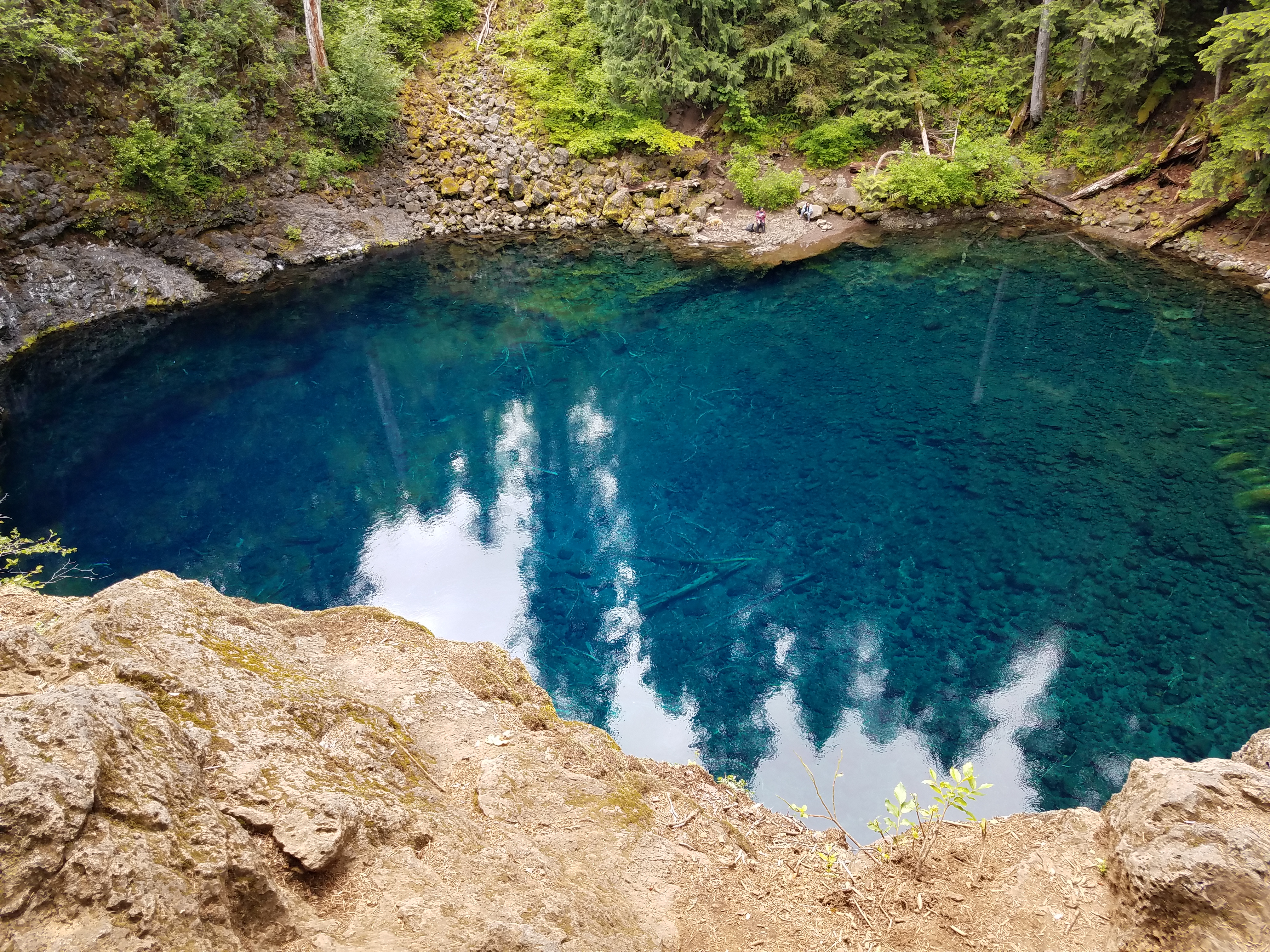
This part of the trail is very technical and very crowded. I’m talking traffic jam crowded. My run was slowed to mostly a walk/pause for uphill travelers. However, this section is beautiful and well worth seeing. Being way overdue to the ‘aid station’, my worried, waiting crew was excited to see me finally run out of the woods and into the parking lot!
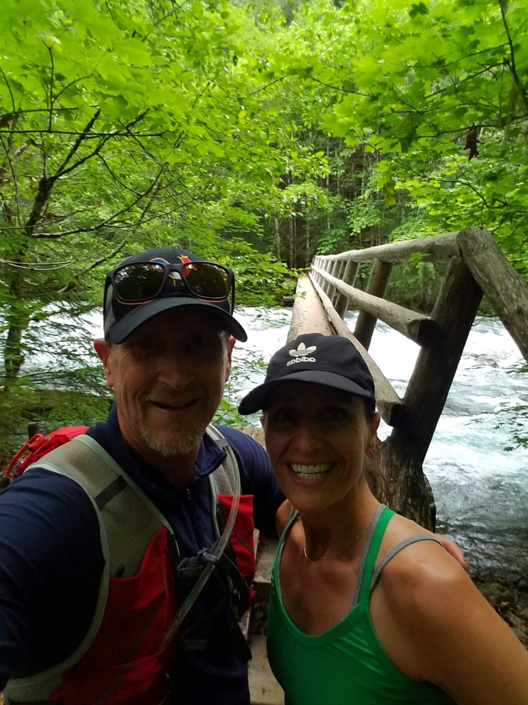
The good news is my wife, Rachelle, joined me for the next leg which was 4.8 miles to Deer Creek Road. This section had a couple of climbs but was mostly sweeping single track through the woods and next to the river. All told, even though the trail starts at approximately 3200′ in elevation and drops to roughly 1750′, in between, my Strava showed there was 1650′ of climbing – so it is not all downhill all the time.
After arriving at the car, we realized that we only had time for one more section. Rachelle decided to run this section too, and it went by quickly. Unfortunately, the slow downs from the technical sections higher up on the trail were unanticipated (as was the wrong turn at the start). Plus, my son had baseball practice to get to. It should be said that I also bribed my crew by promising Coburg Pizza so 3.1 miles later at Frissel Boat Ramp time was up and promises had to be kept. All told it was a 20 mile day, but I will be back to complete the entirety of the trail as it is an amazing journey!

Waterfalls, Waterfalls, and More Waterfalls

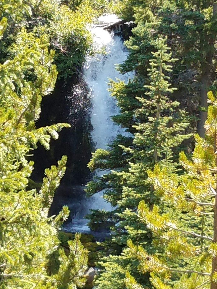
Endless waterfalls seemingly emerge around every corner on the first half of this magical 7 mile loop trail, which follows Tumalo Creek as it plunges it’s way through the eastern Cascades toward Bend, Oregon and the Deschutes River twenty miles away. The spring fed creek emerges from just below picturesque Tam McArthur Rim on the eastern slope of Broken Top and is joined by two other clear mountain streams before dropping 97 feet over Tumalo Falls – the popular main attraction at the trail head.

The Tumalo Falls overlook is a short walk from the parking lot and can be crowded. On our visit, we had to park down the road a little way. These falls are majestic and the draw is understandable. However, the further from the falls you go, the thinner the crowds get and once you are above Double Falls (pictured at the top of this post), the number of people you will encounter dissipates dramatically. Those who turn around at this point, however, miss some picturesque waterfalls in pristine alpine environments.
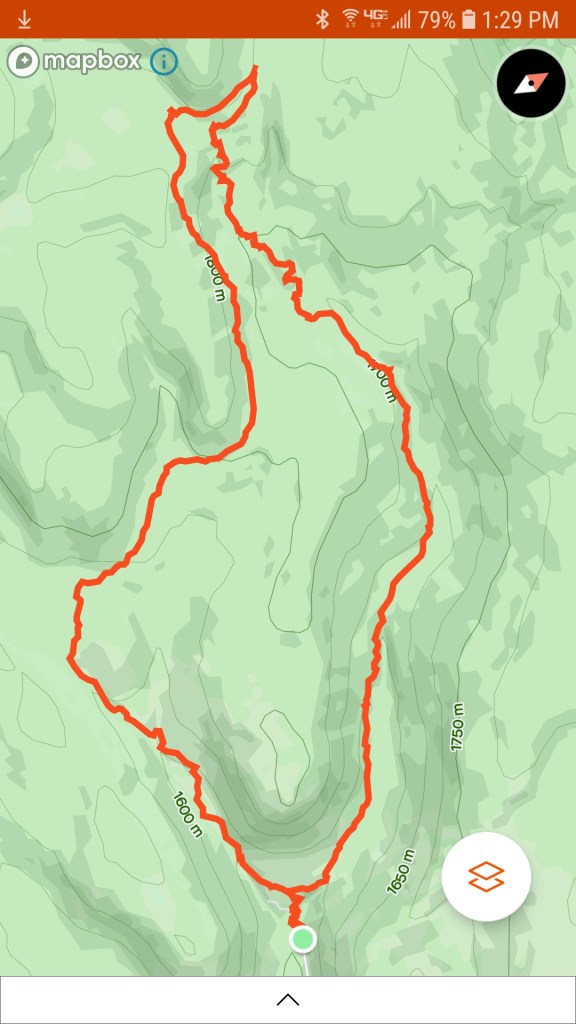
It’s uphill on the North Fork Trail for the first half of the loop moving counter clockwise, but the reward for the hard work is constant, awe-inspiring beauty. Of note, the trail has roughly 1100′ of elevation gain and is also an uphill only section for mountain bikers. You are not always next to the creek, but the sound of rushing water, at times loud and powerful from the falls and at other times a distant whisper like wind through the trees, is constant and soothing.
Near the top, you turn left onto the Swamp Lakes Trail and soon cross the Middle Fork of Tumalo Creek to begin your decent toward Bridge Creek. The crossing here is a bit shaky as an old fallen tree 20 feet upstream from the trail serves as a bridge. The water is crystal clear and feeding trout can be easily spotted. My son and I made a note to come back with our fly rods.
The way back down the second half of the loop steers you through a mix of open manzanita bushes and pine forest. For us, this side was hot and not nearly as rewarding as the first half even though it was primarily down hill. This trip could make for a good out and back solely on the North Fork Trail. However, we would have then missed the 25 foot Bridge Creek Falls which is visible from the lower and final trail of the loop aptly named Bridge Creek Trail (turn left onto this trail) which runs the final 1.1 miles along Bridge Creek back to the parking area.
The Deschutes River Trail

Like all recent races, the Bend Marathon and Half was cancelled this past April due to the Corona virus. The race directors gave entrants a choice between postponing entries to next year or running a virtual race this year before May 31. My wife and I chose to run the virtual half and we chose to run it in Bend, but not on the race course. As we are both nursing some injuries, we decided instead to do a trail run/hike along the Deschutes River from Bend to Sunriver and having lived in Bend in the past, this was a nostalgic journey down memory lane.
The Deschutes River starts high in the Cascades as the outlet of Little Lava Lake and ends up as a major tributary for the mighty Colombia. Almost all of it’s water funnels off the eastern slopes of the Cascades. Originally working it’s way south through Crane Prairie Reservoir before turning northbound at Wickiup Reservoir, the river is one of the main recreational features of Central Oregon. Mountain bikers, rafters, hikers, fishermen, and trail runners populate the trail throughout much of it’s journey. And, it was quite crowded this past Monday – Memorial Day, our virtual race day.

The Deschutes River Trail winds its way past various “falls” that are more like extended rapids running through chutes formed by ancient lava flows when nearby Lava Butte erupted. And, in between each of the falls are meadows, pine forests, aspen groves, wetlands, and soul-cleansing views of the Deschutes. The first part of the trail starts with a mild climb up and away from the river before leveling out and cruising through pines on some technical single track with lots of rocks and roots. Most of the trail is not like that though and is easily navigable.
Lava falls is the first falls that you come to and also your first view of the Newberry National Volcanic Monument. The monument is 54000+ acres and this section of the trail is just across the river from it’s far western boundary. The spectacular lava flows are visible most of the way to Benham Falls, the last of the three falls on this section of the river. Dillon Falls (the second falls) and Benham Falls offer excellent viewing if you have time to stop, which we did!

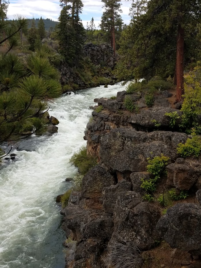
Along the trail, the river keeps things interesting by revealing it’s split personality time and again. Calm, smooth, and quiet sections create a meditative environment enjoyed by stand up paddle boarders and kayakers alike. But, not far from these peaceful, glassy passages, the river’s tumultuous personality rears itself in powerful rapids and turbulent waterfalls. Incredibly, kayakers have successfully run these rapids including class V+ Benham Falls.
Just past Benham Falls, you find yourself on a wide, straight, and somewhat crowded gravel path until you reach the bridge that crosses the river. Turn right here to stay on the trail. For us the crowds vanished at this point. After a short time, river views are left behind as you wind through a lodgepole pine forest before hitting the pavement at Circle 7 in Sunriver. This part seemed to pass by quickly as the trail was slighlty downhill and curved nicely through the trees. We ended up a mile short of our half marathon distance so we kept running through Sunriver until we hit the magical number – 13.1. And, it was time to celebrate!

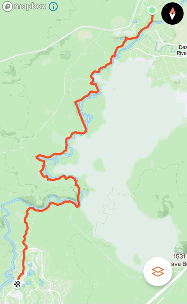
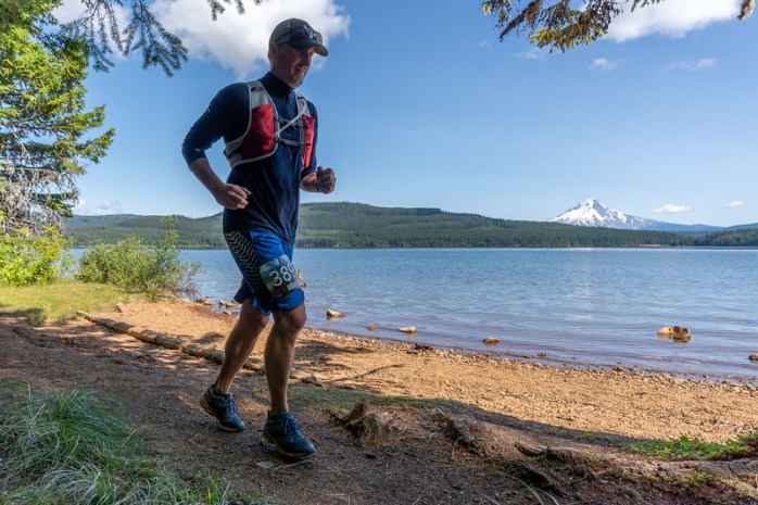
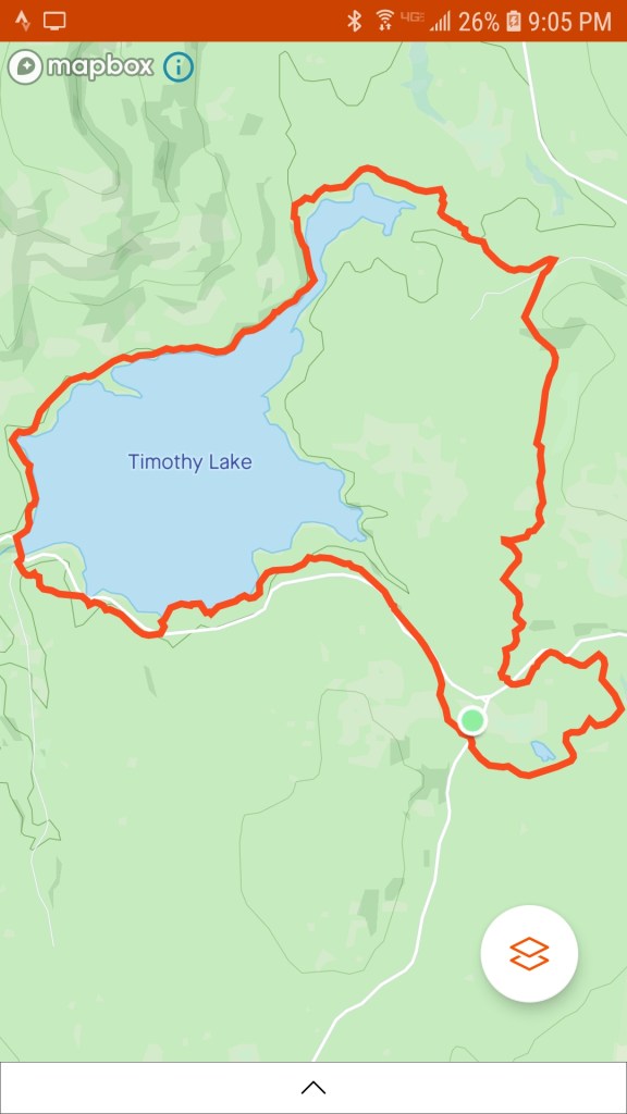
Timothy Lake

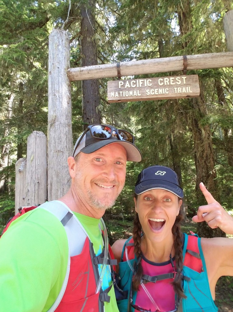
Timothy Lake was formed when Pacific General Electric built a dam in 1956 to regulate water flow to Lake Harriet 21 miles down stream. This picturesque Cascade lake is located off of NFS Rd 4280 and has both developed and undeveloped campgrounds located in various areas around the lake. The Pacific Crest Trail runs the length of the east side of the lake where hungry, trail-worn thru hikers travel, excited to get to Timberline Lodge on Mt. Hood to take advantage of their renowned all-you-can eat buffet.
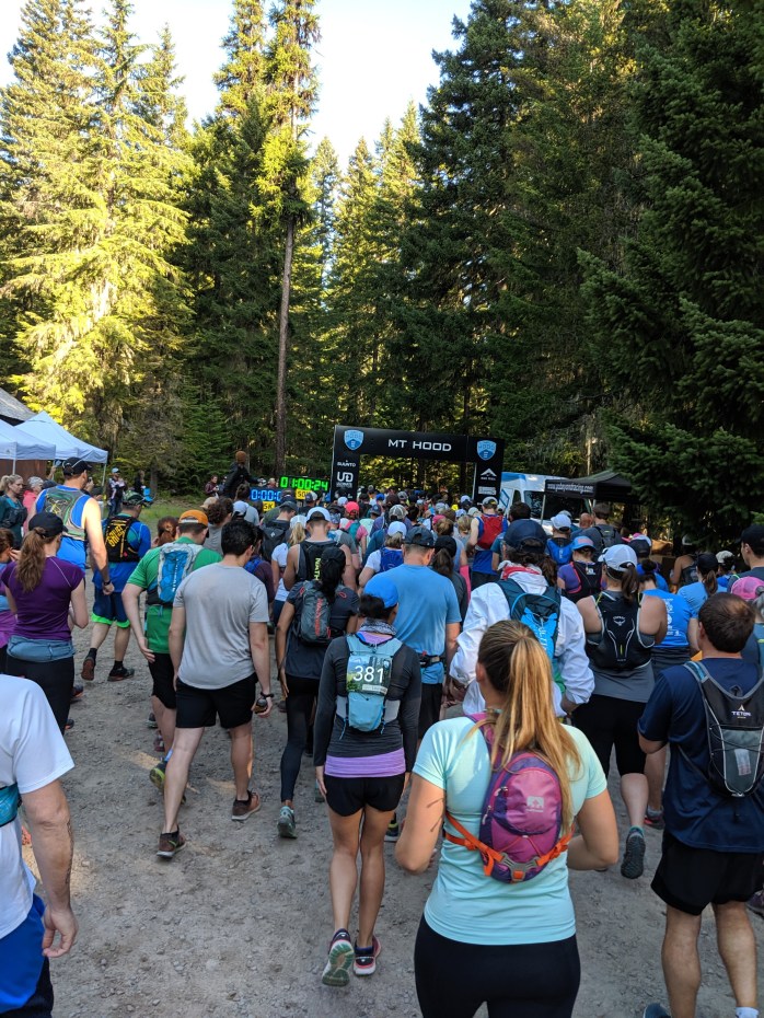
We have thoroughly enjoyed running this multi-use trail twice and it is not surprising to run into occasional mountain bikers and horseback riders. The first time we ran the trail was for a race course inspection/training run while the second time was as entrants in the Mt. Hood 25K, a popular race held each July (but, unfortunately cancelled this summer due to Covid-19). The 15.5 mile trail has little elevation gain or loss and the race course actually leaves Timothy Lake for about half the mileage. So, if you are in the mood for a shorter run, you can slice a few miles off by running the PCT section that skirts the water.
Starting on the Miller Trail at the Clackamas Ranger Station, we merged onto the Headwaters Trail which circumnavigates marshy Clackamas Lake. From this point it was onto the Old 1916 Trail where there are some mild elevation gains and losses before beginning a long, gently flowing descent leading to a brief intersect with the PCT. From here you cross the bridge over the inlet that, in part, comes from Little Crater Lake – a colorful, very small lake that looks nothing like its larger namesake, but worth the side trip if you have time.
After rounding the north arm, the Timothy Lake Trail runs above the shoreline through the trees for 4 miles past several undeveloped campsites and above Meditation Point, a small peninsula pointing to the middle of the lake. The trail from the north arm to the dam is flat and fast and seems to go by quickly.
Crossing the dam, diagonal to the right onto the final four mile section of trail. If you hug the water here, you will find your way back, but you will end up running through crowded campsites and add an extra mile to your journey. Whereas, if you stay uphill from the water, you run through quiet forest away from the crowds. This final leg is a slight climb back through scenic forest to the ranger station.
Finishing races is always rewarding and the after party at the Mt. Hood race is one of the best!!

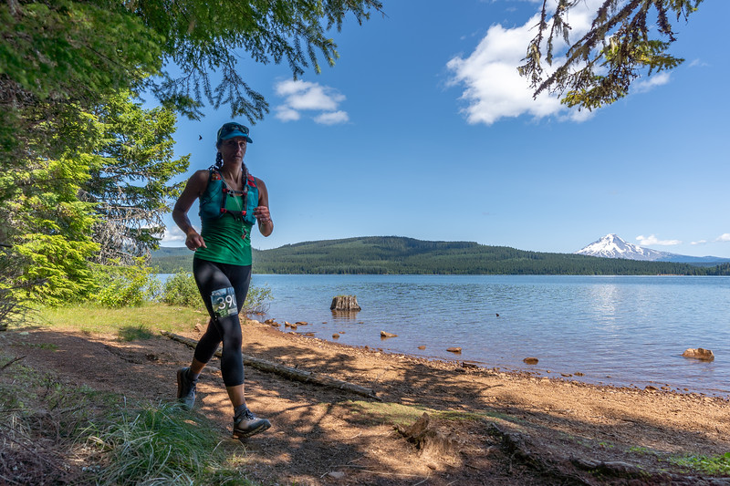
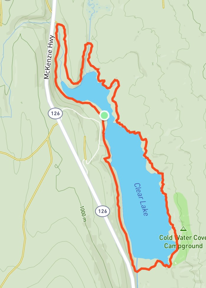
Clear Lake Loop

This is one of our favorite quick getaways for a trail run in the Cascades. Located off Hwy 126, near the Hwy 20 junction, Clear Lake is easily accessible from either the Willamette Valley or Central Oregon. The lake gets it’s namesake from water so clear that you can often see 100 or more feet down. In fact, if you decide to do some boating (no motors allowed), you will be rewarded with the surreal sight of ancient trees and cutthroat, brook and rainbow trout below the surface and ever opportunistic ospreys and bald eagles above. The spring fed lake serves as one of the headwaters for the iconic McKenzie River.
For the most part, we choose to run this trail in a clockwise fashion so that is the direction described here. It is roughly 5 miles long with very little elevation gain or loss.
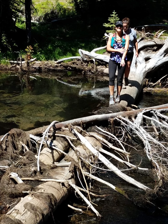
Start at the Clear Lake Resort after parking in the day use parking lot. Then run down the road in front of the rental cabins to reach the trail. At this point, fantastic, slightly rolling single track guides you through old growth forest before coming to your first of five bridge crossings – over Ikenick Creek and around the first northern finger of the trail. Further along, you return to the lakeside where the view south across the bright blue water is breathtaking. Leaving the lake and heading north again on the next finger, you will come to a junction with the McKenzie River trail. Turn right here and cross the second bridge over Fish Creek. Interestingly, every time we have run this trail this particular creek has been dry.
After some fun and winding single track, you find yourself running next to a beautiful spring with stunning color and clarity.This is one of the originating springs that fill the lake and feed the McKenzie River. Just past this point you will begin to see lava and an entirely different landscape. The dirt transforms to somewhat technical rock then eventually to an asphalt trail toward the southern end of the lake. A quick run through a willow tunnel leads you around the southeast corner and back into the trees where you will come to a junction. Make sure to stay right on the Clear Lake trail. Going left keeps you on the McKenzie River Trail (future post coming soon!). When you reach the McKenzie River bridge, take a moment to look down into the water along the banks to easily spot feeding trout. From this point on, the remainder of the run is smooth open trail as you cruise through shaded old growth forest and cross two smaller bridges reaching the resort one mile later.
It’s important to note that the resort has rowboat and kayak rentals as well as a restaurant in case you are hungry after the run! Click here for more information about the trail.
The Metolius River Trail

Being one of Oregon’s epic and most popular rivers, the Metolius has fantastic trail systems with numerous options. The headwaters starts at the base of Black Butte by miraculously gurgling from lava tubes deep underground as a full size river that never changes temperature or flow. The free flowing Metolius is also classified as a National Wild and Scenic River in order to preserve it’s outstanding natural, recreational and cultural values. For the most part, fairly flat single track follows both sides of this river for miles which makes for great trail running with the crystal clear water always at your side.
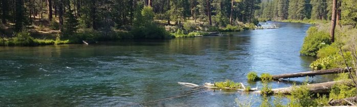
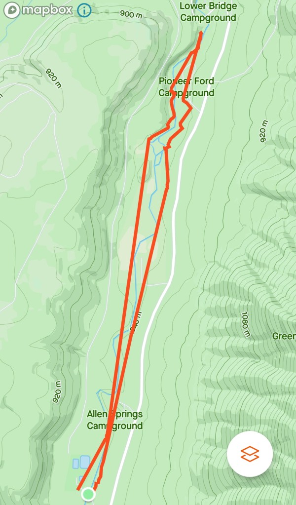
The roughly 5.6 mile adventure began by parking at the Wizard Falls Fish Hatchery, crossing the bridge and heading north on the trail – running this loop in a counterclockwise fashion. The trail hugs the meandering contours of the river as you wind your way through the well spaced, mature ponderosa pines and sage brush. We ran this trail with our two teenagers in mid-June, mid-afternoon, last summer. It was warm. The trail was dusty, so hydration vests were a must.
On this side of the river, you first pass through Allen Springs Campground, one of the many campgrounds in this popular summer getaway. Just past Allen Springs, we paused after noticing a large rainbow trout in the slack water behind a rock feeding lazily feeding on nymphs as they floated by in the current, but we continued on as this trout was apparently unafraid of the four people staring down from above.
About half way along the trail on both sides of the river, you reach a fenced off section of private property that you have to run up and around before diving back down to the water again. The apex of the loop is Lower Bridge Campground where you cross the bridge to head back. We took a quick break next to the large pool by the bridge and watched two buddies unsuccessfully try to lure a bull trout from it’s depths.
Below, is my daughter running a section of the trail on our way back toward the hatchery. It is a good representation of the well maintained single track that is good for running. This side of the river seemed a bit more forested and shaded which helped in the heat. The overall experience of this trail was a magical Metolius moment…
And, of coarse, the Camp Sherman store is a must post-run for good eats, local hospitality and a cold beer.
Running in nature – the ultimate ELIXIR!

For me, the benefits of running by far outweigh the pain. And when I run on the incredible variety of Oregon’s trails, it becomes adventurous, therapeutic, inspiring, and healing all at once! My wife loves to run too, so we get to spend time adventuring together on mountain trails. We thrive on covering miles and seeing all this beautiful state has to offer.
Why do I like to run?
Running helps me push my boundaries and grow mentally and physically stronger. Many people I admire have said that you can not grow if you strive to stay comfortable. I absolutely believe this and have lived it. Every time I choose comfort, I don’t have growth in any area of my life and even see some reversal in any gains that have been made. I run to seek discomfort and I have learned that when I push further into ‘the pain cave” I come out a stronger person on the other side. The lessons learned from running carry over into other aspects of my life as well.
Then there are the health benefits!
I used to weigh 50 lbs more than I do now. I had high blood pressure and high cholesterol and was on medication for both by the time I was in my mid 30’s. I was a dad with two young children, on a path towards chronic disease, and I wanted to make sure that I would be around to see them graduate and to hopefully even see their kids graduate. I began by walking some, then walking/running, and then started a workout program – P90X. This helped, and I lost weight, but I still needed medication. It wasn’t until adopting a whole food/plant-based diet that I really lost the necessary pounds and was able to get off the medications. My energy reached new levels which allowed me to start working out more and to start to push myself toward new levels of fitness. Two years ago my wife and I discovered that we loved to run trails. Trail Running combines our love for the outdoors and our passion for exercise. Running brought us to trails in Oregon that we had never really explored before. A passion was born! And now, I want to share the experiences from our Oregon trail runs (and hikes) and to hopefully inspire others to get out on the trails.
Introduce Yourself (Example Post)
This is an example post, originally published as part of Blogging University. Enroll in one of our ten programs, and start your blog right.
You’re going to publish a post today. Don’t worry about how your blog looks. Don’t worry if you haven’t given it a name yet, or you’re feeling overwhelmed. Just click the “New Post” button, and tell us why you’re here.
Why do this?
- Because it gives new readers context. What are you about? Why should they read your blog?
- Because it will help you focus your own ideas about your blog and what you’d like to do with it.
The post can be short or long, a personal intro to your life or a bloggy mission statement, a manifesto for the future or a simple outline of your the types of things you hope to publish.
To help you get started, here are a few questions:
- Why are you blogging publicly, rather than keeping a personal journal?
- What topics do you think you’ll write about?
- Who would you love to connect with via your blog?
- If you blog successfully throughout the next year, what would you hope to have accomplished?
You’re not locked into any of this; one of the wonderful things about blogs is how they constantly evolve as we learn, grow, and interact with one another — but it’s good to know where and why you started, and articulating your goals may just give you a few other post ideas.
Can’t think how to get started? Just write the first thing that pops into your head. Anne Lamott, author of a book on writing we love, says that you need to give yourself permission to write a “crappy first draft”. Anne makes a great point — just start writing, and worry about editing it later.
When you’re ready to publish, give your post three to five tags that describe your blog’s focus — writing, photography, fiction, parenting, food, cars, movies, sports, whatever. These tags will help others who care about your topics find you in the Reader. Make sure one of the tags is “zerotohero,” so other new bloggers can find you, too.
